RENT A BIKE / E-SCOOTER - Preko - Ugljan
useful links:
Bike apps:
|


The island of Ugljan is ideal for cycling – for family excursion or attractive mountain trail. Suggested routes for groups or individuals: > 1. ROUND TRIP TROUGHT THE COASTLINE: > 2. PREKO - MULINE - North route - island of Ugljan > 3. PREKO - ST. MICHAEL- ascent and panoramic view on Zadar arhipelago > 4. PREKO - ŽDRELAC BRIDGE - South route - island of Ugljan > 5. PREKO - ŽDRELAC BRIDGE - PAŠMAN - South route - island of Ugljan and Pašman
If you are looking for easy ride trough the coastline, without big effort, this route is the right choice. Recommended also for familes with children. Route goes through scenic coastal route without using of the island main road with cars. Distance:cca 20 km Intensity: Low
>>> MORE INFORMATION AND PICTURES ABOUT ROUTE
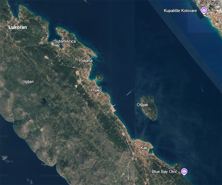
Start from Preko ferry port, trought Poljana, Sutomišćica, Lukoran and to Ugljan and Muline. Return on off road or by island main road. Distance:cca 33km Intensity: Low to medium >>> MORE INFORMATION AND PICTURES ABOUT ROUTE
Start from Preko ferry port, passing trought olive fields to St. Michael fortress, where you can see fantastic panoramic viewing of whole Zadar archipelago. Route is suggested for well prepared cyclists, with experience on climbing on steep hills. Distance:cca 15 - 20km Intensity: Medium to hard >>> MORE INFORMATION AND PICTURES ABOUT ROUTE
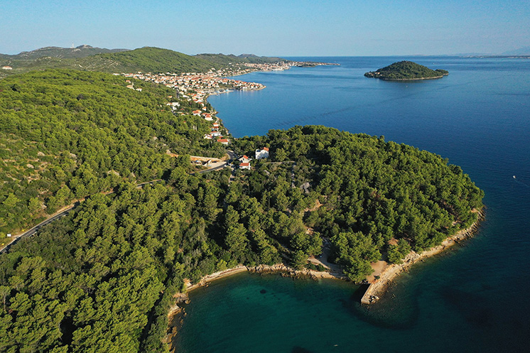
Start from Preko ferry port, passing trought Kali, Kukljica to the Ždrelac bridge and back. Distance:cca 30km Intensity: Low >>> MORE INFORMATION AND PICTURES ABOUT ROUTE
Start from Preko ferry port, passing trought Kali, Kukljica to the Ždrelac bridge and crossing to island of Pašman. After passing Ždrelac bridge, on southwestern side of island of Pašman island, there is panoramic gravel road. Alternative way is the main road which leads you directly to Tkon passing all the places on Pašman island. Distance from Preko to Tkon is about 30 km. Route is recommended for well prepared cyclists. Distance: cca 60km from Preko to Tkon and back Intensity: Medium to Hard
|